
Dubai Metro Map While there are many options for travelling in Dubai, nothing is quite as easy as using the Dubai Metro Map to get around this city. This available transportation option connects the most notable attractions, shopping areas and business districts that Dubai has to offer. This is a must-do for your trip to Dubai. Even if you are a first-time guest, or someone who travels here often, knowing the metro station map means it will process smoothly.

Understanding the Dubai Metro System and Its Network of Routes
There are two main lines that make up the Dubai Metro, which you can see with ease on the Dubai Metro Station Map: the Red Line and the Green Line. The Red Line extends all across the city from Dubai International Airport to important sights like Downtown Dubai, Dubai Marina, and Expo City. The Dubai Metro Green Line Map covers the central areas of the business, and cultural areas, so it is great for travelers in work and leisure.
You can easily find out which line to take, find interchange stations, and plan for trips ahead in the UAE Metro Station Map, to make it simple to use, and provide a seamless travel experience of getting around.
Why the Dubai Metro Map Is Essential for Tourists and Residents
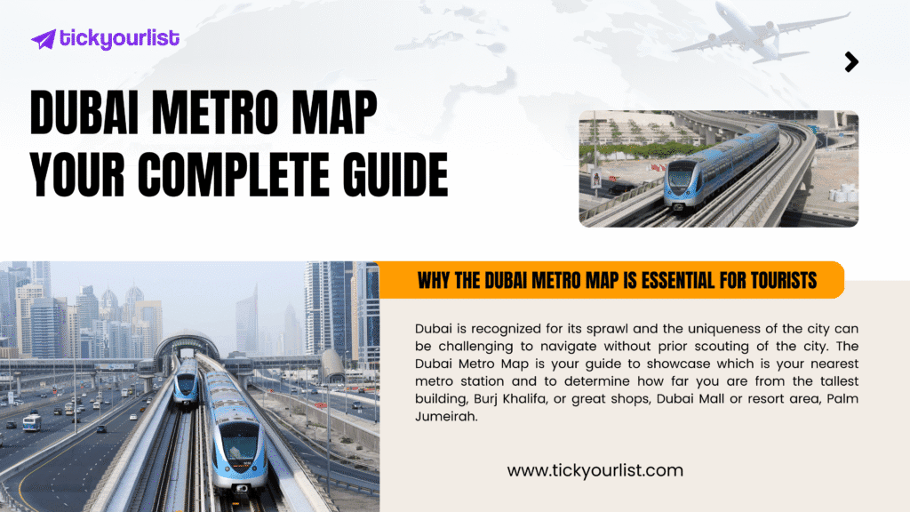
Dubai is recognized for its sprawl and the uniqueness of the city can be challenging to navigate without prior scouting of the city. The Dubai Metro Map is your guide to showcase which is your nearest metro station and to determine how far you are from the tallest building, Burj Khalifa, or great shops, Dubai Mall or resort area, Palm Jumeirah. The metro station map, for tourists in Dubai, is a go to trusty place to reference to maximize your time and plan ahead, and to ease the headache of traffic delays.
For residents, with the Dubai metro station map, it gives a cheaper way of commuting on a daily basis, especially since the metro has links with other public transport such as buses and trams.
Exploring the Red Line and the Green Line with the Dubai Metro Station Map
The Red Line is the longest and most utilized part of the UAE Metro Station Map. It interconnects several popular areas of the city, ranging from both terminals at the airport to the lively Marina area, making it a great option for visitors wanting to stop by some of the top attractions in the city.

The Dubai Metro Green Line Map centers around the older, more cultural side of the city. With routes through Deira and Bur Dubai, travelers have access to traditional souks, museums, and heritage centers without worrying about the traffic.
Key Attractions You Can Access with the Dubai Metro Map
The map of the metro stations no longer presents a catalogue of stations; it offers the route for you to visit some of Dubai’s most popular locations. You can stop at Burj Khalifa/Dubai Mall station to visit downtown Dubai, go directly to Dubai Marina, and take an obligatory evening walk by the water, or go to Expo City to see the futuristic attractions.
You can visit cultural treasures like the Gold Souk, Spice Souk and Al Fahidi Historical District while on the Dubai Metro Green Line Map. Keep the Dubai Metro Station Map close by to experience Dubai’s best experiences.
Planning Your Journey with the UAE Metro Station Map
With the UAE Metro Station Map, the planning of your trip is no longer an issue. You can see how many stations are between your starting point and destination, understand your interchange options, and prepare for transfers in a timely manner. Don’t be afraid to put in the time researching how to better spend your time in Dubai whether you are heading to work meetings or spending a day sightseeing.
Other than being air-conditioned, the metro is comfortable, on time, very reliable travel, which is why it is now distinguished as being one of the an best ways to get from A to B. Providing you have the Dubai Metro Map, you will remain on the right path without stressed-up with traffic or a costly Taxi.
Where to Find the Dubai Metro Map for Easy Reference
The Dubai Metro Station Map can be found at every station, inside trains, and on official apps for quick access and reference. I would also suggest having a digital copy on your phone to help you keep track of the different lines. The UAE Metro Station Map is periodically updated with the expansion of the metro to let travelers know about the accurate routes.
Book Your Travel Experiences with TickYourList for the Best Offers
The Dubai Metro Map helps you learn your way around the city. When you are ready to plan your activity, then you can use TickYourList to better plan your adventures and find exclusive deals and the best price for attractions throughout Dubai. Whether it is a theme park, a cultural landmark, or something even bigger, TickYourList has a seamless and simple way to book your activity online and save money in the process.
Frequently Asked Questions (FAQs)
Q1: Where can I get a copy of the Dubai Metro Map?
You can find the Dubai Metro Map at metro stations, inside carriages, and online. It is also available on mobile apps for easy access.
Q2: What is the difference between the Red Line and the Dubai Metro Green Line Map?
The Red Line connects major modern landmarks like Downtown Dubai and Marina, while the Dubai Metro Green Line Map covers historic and cultural parts of the city like Deira and Bur Dubai.
Q3: Is the Dubai Metro Station Map available in English?
Yes, the Dubai Metro Station Map is multilingual, making it easy for international travelers to understand and use.
Q4: Can I rely on the UAE Metro Station Map for daily commuting?
Absolutely. The UAE Metro Station Map is reliable for both tourists and residents, ensuring punctual and cost-effective travel across the city.
Q5: Where can I book Dubai attractions after planning my metro journey?
You can book your tickets for attractions and experiences at TickYourList, which offers the best price and online booking convenience.


